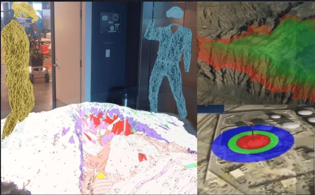
Integrate and consolidate data from various assets and sources into a unified XR, VR & AR platform to provide a multi source & multi user view through Mixed Reality glasses, PC or tablet.
GIS, UAV, UGV, USV (Drones), 5G, Internet of Things (IoT), Artificial Intelligence, Video Streaming & more
YOU'RE IN GOOD COMPANY
Operations that we've enhanced
We do a total immersion in your operations to deploy mixed reality to your service, achieving greater efficiency and minimizing risk in the fields of Emergency Management, Military and Corporate Sectors.
We dream of NEOM and its vision as a hub for innovation, trade, and entrepreneurship. We humbly assist the urban planning team in making better decisions and delivering faster.
The acronym NATO CWIX stands for NATO Coalition Warrior Interoperability eXercise. We are proud to be part of the 2023 edition, where we will confirm our ability to interoperate with multiple capacities in multinational military operations.
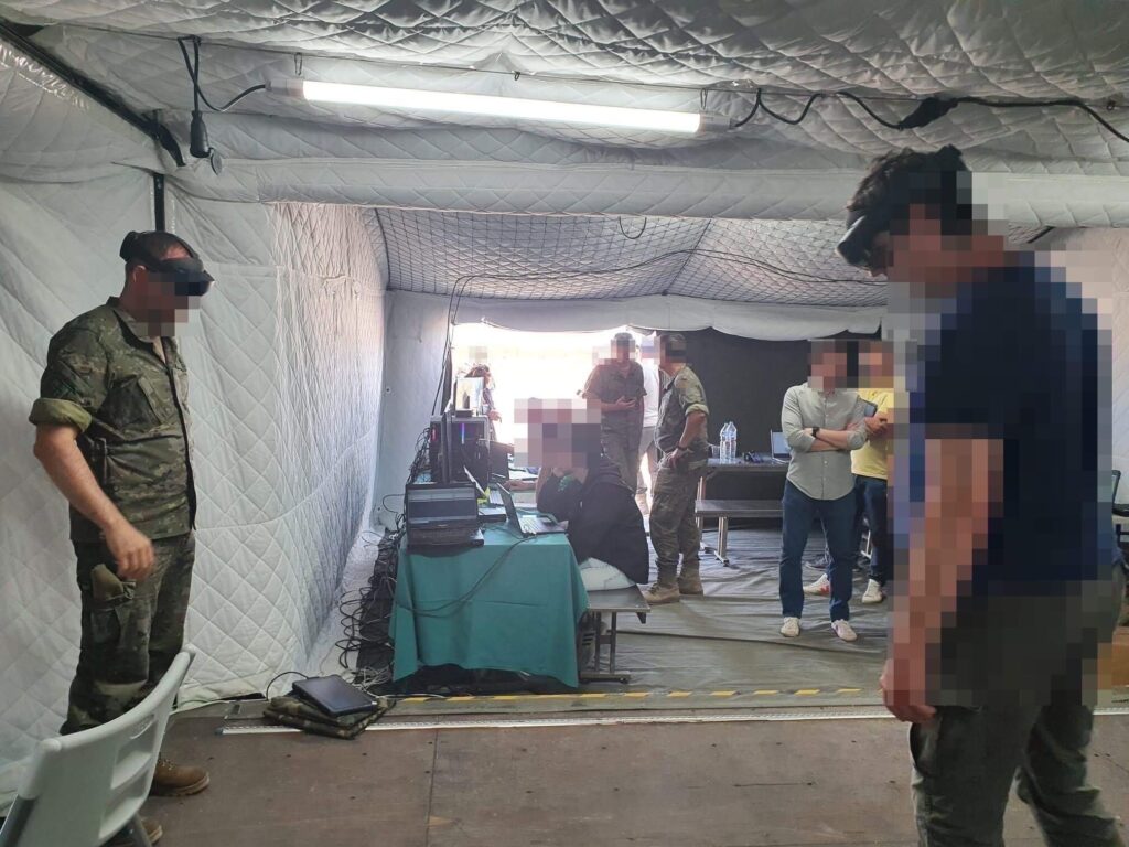
We have been challenged to improve the training and decision-making capabilities of Spanish Army officers. Furthermore, we have been challenged to combine virtual and real assets into a single, intuitive platform. Challenge accepted.
With the environmental team of the Cabildo de La Palma, we are continuously learning how to add value in emergency management such as wildfires. We continue working on the integration of mathematical simulation models and resource management.
XRSANDBOX EMERGENCIES
Emergency management with virtual control centers & advanced training
In emergencies effective decision-making relies on two key factors:
The expertise of individuals involved
Access to comprehensive and up-to-date information.
However, simulating real-life scenarios for specialist training remains costly and often theoretical. Furthermore, current software’s ability to represent limited available information lacks user-friendly interfaces and immersive experiences.
Achieving informed decision-making in command positions
We excel at gathering comprehensive and relevant information, including GIS data, resource positions, and other pertinent data. Our thorough analysis process evaluates the reliability of the information, incorporating real-time data for accurate insights.
When considering alternatives and assessing potential outcomes, we utilize virtual training to explore various options, weigh their advantages and disadvantages, and identify potential risks and benefits.
With XRSandbox, decision-making and communication are greatly simplified. We seamlessly share content and communicate in real-time, regardless of physical location. This proves particularly valuable in addressing conflicts that demand immediate attention, irrespective of participants’ whereabouts.
Improve Situational Awareness and Efficiency: Gain a real-time view of operations and data, providing managers with enhanced awareness of their organization’s performance. This leads to quicker issue identification, uncovering opportunities, and making informed decisions, ultimately reducing costs and enhancing overall performance.
Enhance Collaboration: Facilitate effective collaboration among managers and employees, regardless of their locations. By leveraging XRSandbox’s shared virtual environment, teams can seamlessly collaborate, share information, and gain valuable insights.
Drive More Effective Training: Utilize simulated environments to train employees, especially in complex or hazardous situations, leading to more effective and safe training experiences.
Enable Better Decision-Making: Empower managers with accurate and detailed information for improved decision-making. This allows them to identify trends, forecast outcomes, and evaluate the impact of different decisions, resulting in better overall decision-making.
We are part of Telefonica’s 5G combat and emergency cloud. We are part of the strategy to display real-time content (streaming, IoT, GPS, communications, etc.) of everything that happens in the management of a modern command and control center.
As ESRI partners, we have the ability to integrate geographic systems and layers of geo-referenced information. We are integrated with world leaders in land management and represent operational scenarios through holograms.
XRSandbox integrates proprietary modular technologies in mechanics, electronics, autonomous navigation, cloud and artificial intelligence that allow configuring customized solutions. Now, using XR the operators can have a 360 streaming experience plus the ability of actually move this amazing UGV.
UAV and unmanned helicopters that makes possible to document and evaluate the status and evolution of assets and events of a territory, installation or surface in a precise, fast and geo-referenced way using LiDAR devices.
Design and development of unmanned marine vehicles and their associated systems. Managing projects from generation to manufacturing thanks to a team of professionals in different areas such as naval, telecommunications and industrial design.